Case study · Field hydrogeology · MSc thesis
Where do Guatemala’s coastal mangroves get their freshwater?
The Retalhuleu district holds the largest mangrove area on Guatemala’s southern Pacific coast (5,111 ha) — a groundwater-dependent ecosystem where fresh groundwater discharge regulates salinity levels. The same aquifer is the main source of drinking water and irrigation for a booming agricultural region, yet almost no hydrogeological information existed. Mangrove area experience a long dry season, and therefore use groundwater.
What we did
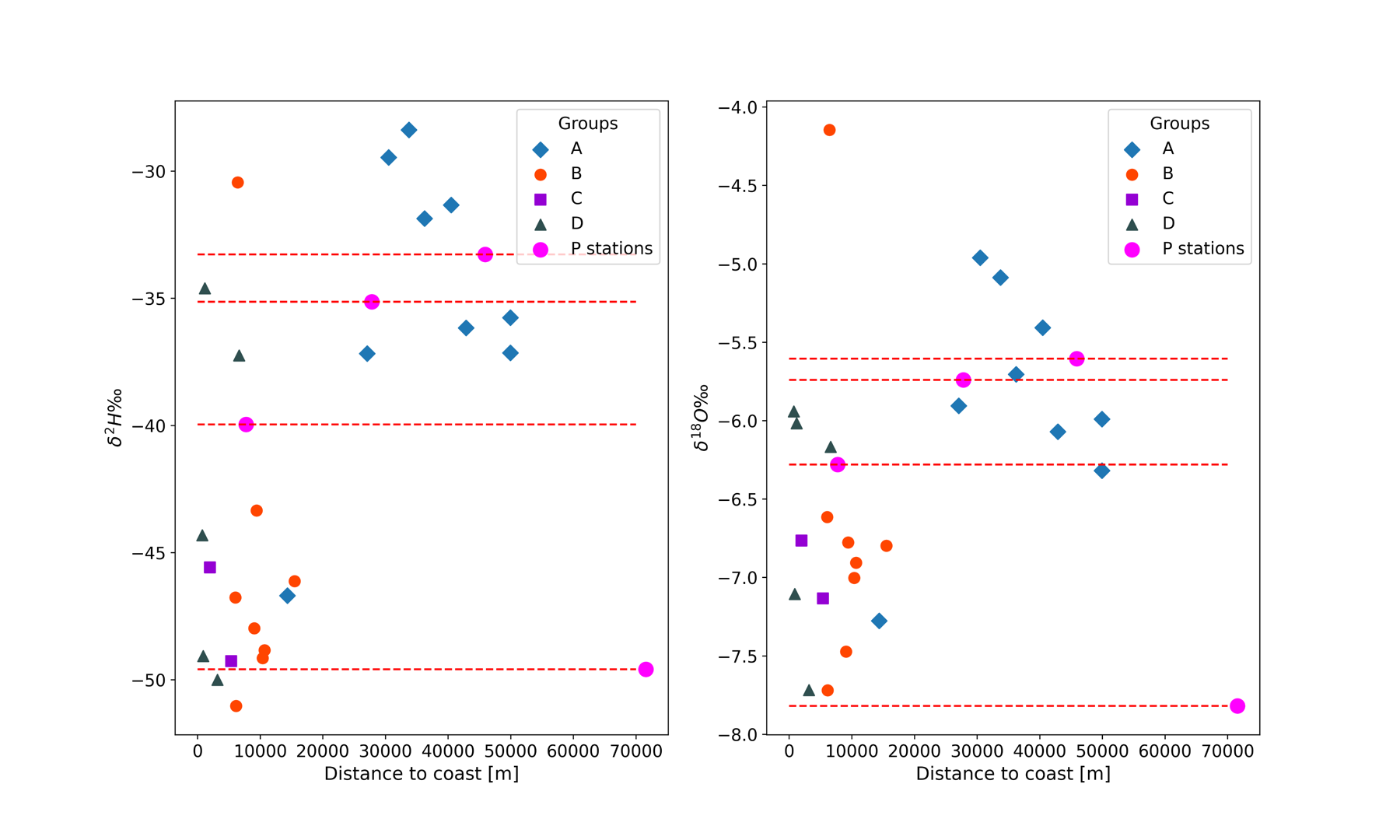
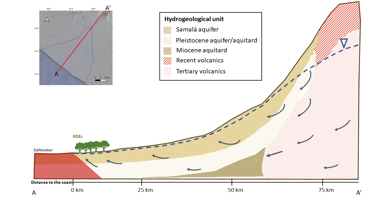
A dry-season field campaign across the Samalá alluvial aquifer: inventorying wells, measuring groundwater heads, and sampling for hydrochemistry and stable isotopes (δ18O, δ2H). Three independent lines of evidence were combined into one conceptual flow model: water chemistry evolving from Ca-HCO3 inland to Na-HCO3 at the coast – evidence of long flow paths through carbonate diss. and cation exchange; isotope signatures at the coast too light to be local rain, matching precipitation that fell high on the volcanic arc; and a water balance with recharge estimation to close the story.
What we found
The water discharging into the mangrove forests is deep, long-traveled groundwater recharged on the slopes of the volcanic highlands, tens of kilometers upstream — not local rainfall. That single finding reshapes how the system must be managed: protecting the mangroves means protecting recharge areas far inland, and sustainability depends on long-term average recharge rather than local droughts. Because the water travels for years, even strong El Niño events barely touch the groundwater system that keeps the mangroves alive. Groundwater heads near the coast already dip below sea level, so the balance is delicate: excessive pumping risks saltwater intrusion and would shift the salinity gradient that sets the natural zonation of mangrove species.
Cantarella, V. P. (2022). Hydrogeological investigation in coastal mangrove ecosystems of the Pacific coast of Guatemala. MSc thesis, GroundwatCH (IHE Delft · IST Lisboa · TU Dresden), hosted by ICC Guatemala.