Cantarella Labs

Case study · Field instrumentation · In development

Measuring the rain that models miss — anywhere

Extreme rainfall events are often missed by even the most advanced numerical models — the only way to catch them is to measure on site. Worse, the rain that matters tends to fall far from any connectivity, so getting the data out is the hard part.
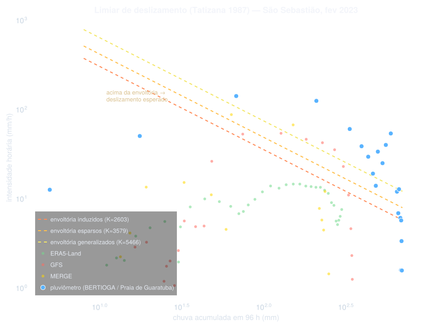
Rainfall intensity versus 96-hour accumulated rain for the February 2023 São Sebastião landslide event: only the on-site rain gauge crosses the Tatizana landslide-threshold envelopes; ERA5-Land, GFS and MERGE stay below them
A recent landslide event (São Sebastião, Brazil, February 2023) seen by an on-site rain gauge versus gridded rainfall products: only the gauge (blue) crosses the intensity–accumulation thresholds used for landslide warning — the models would have stayed silent.
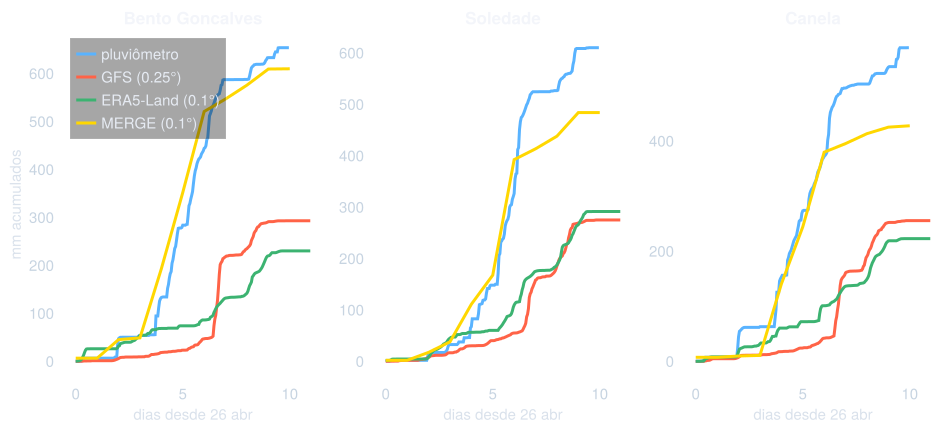
Cumulative rainfall curves at two stations during an extreme event: the rain gauge accumulates far more rain than the GFS and ERA5-Land gridded products
The same blind spot in accumulated rainfall: through the event, the gauges (blue) consistently outpace the gridded products.

I am developing the next generation of modems for environmental applications, built on the new 3GPP NTN standard — NB-IoT via satellite. It slashes the hardware requirements and cost of satellite communication, making it viable to deploy rain gauges and other sensors far beyond cell coverage — and to build the dense monitoring networks that landslide early warning needs.
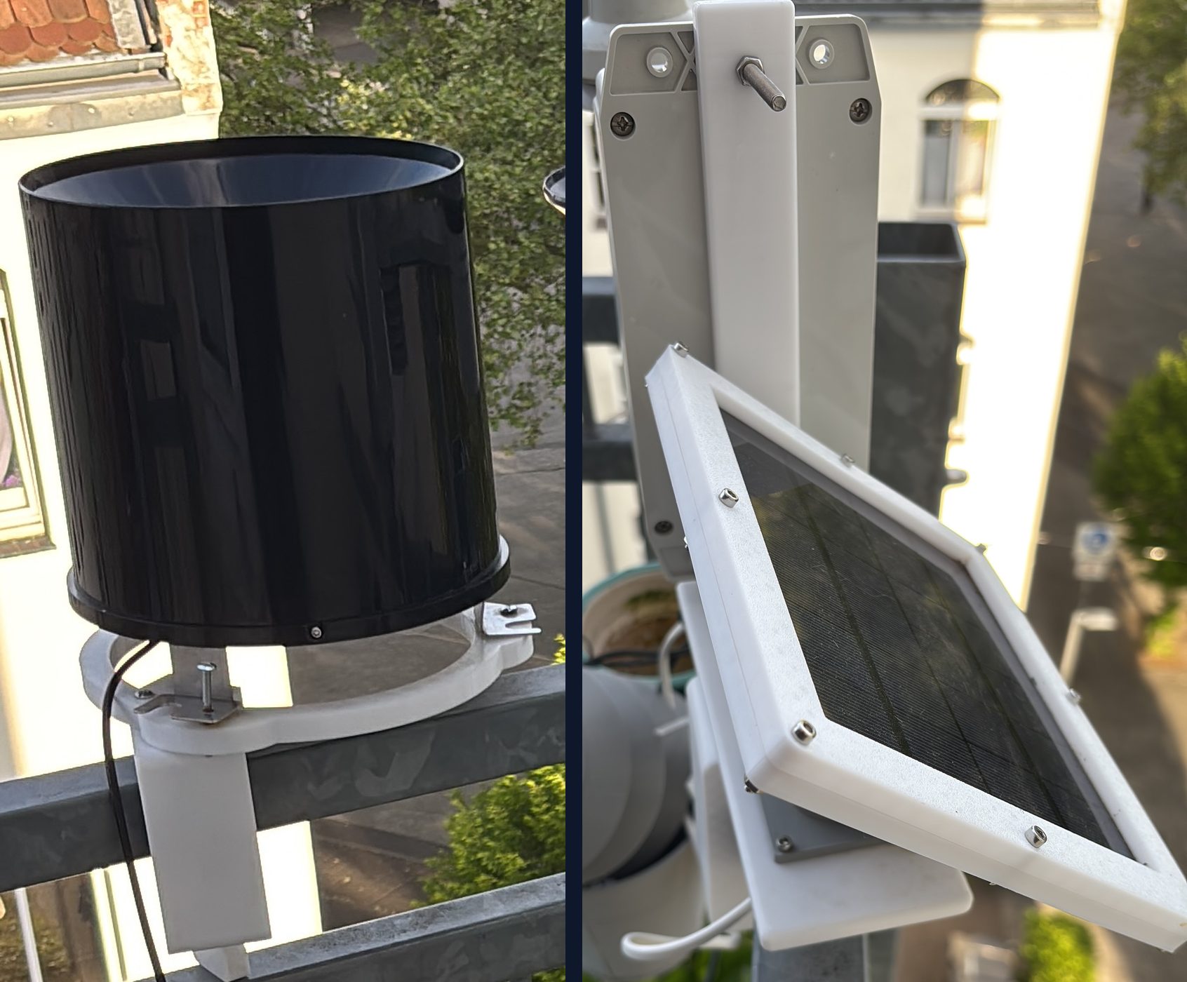
Early prototype of the monitoring station: a tipping-bucket rain gauge on a 3D-printed mount, and its solar panel in a 3D-printed frame
The early prototype on test: tipping-bucket rain gauge and solar power, on 3D-printed mounts.